"See the Impact of Disaster with a Drone: Get an Accurate Picture of Damage Quickly and Easily."
Introduction
Drones have become an invaluable tool for surveying damage and assessing the impact of a disaster. They can provide a bird’s eye view of the affected area, allowing for a more comprehensive assessment of the damage. Drones can also be used to monitor the progress of recovery efforts, providing real-time data that can be used to inform decision-making. In addition, drones can be used to deliver aid and supplies to those in need, providing a much-needed lifeline in the aftermath of a disaster. This article will explore the various ways in which drones can be used to survey damage and assess the impact of a disaster.
How Drones Can Help You Quickly Assess Damage After a Disaster
In the wake of a disaster, it is essential to quickly assess the damage in order to begin the process of recovery. Drones can be a valuable tool in this process, providing an efficient and cost-effective way to survey the affected area.
Drones are equipped with high-resolution cameras that can capture detailed images of the affected area. This allows for a comprehensive overview of the damage, which can be used to create a plan for recovery. Additionally, drones can be used to monitor the progress of recovery efforts, ensuring that the necessary steps are being taken to restore the area.
Drones can also be used to access areas that are difficult to reach. This is especially useful in the case of natural disasters, such as floods or earthquakes, which can leave roads and other infrastructure damaged or blocked. By using drones, it is possible to survey the affected area without having to risk the safety of personnel.
Finally, drones can be used to provide assistance to those affected by the disaster. For example, drones can be used to deliver medical supplies or food to those in need. This can help to reduce the amount of time it takes to provide aid to those affected by the disaster.
In conclusion, drones can be a valuable tool in the assessment and recovery process following a disaster. By providing detailed images of the affected area, monitoring the progress of recovery efforts, and providing assistance to those in need, drones can help to ensure that the recovery process is as efficient and effective as possible.
The Benefits of Using Drones to Survey Damage After a Disaster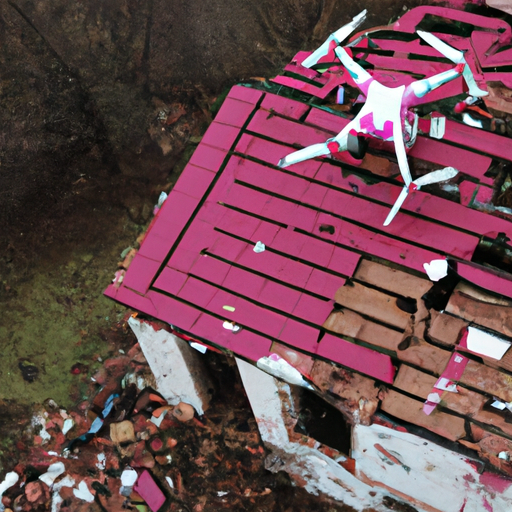
The use of drones to survey damage after a disaster has become increasingly popular in recent years. This technology offers a number of benefits that can help to speed up the recovery process and reduce the cost of repairs.
One of the primary benefits of using drones to survey damage after a disaster is the speed and accuracy of the data collected. Drones can quickly and efficiently survey large areas, providing detailed images and data that can be used to assess the extent of the damage. This data can then be used to create accurate maps and models of the affected area, allowing for more efficient and effective recovery efforts.
Another benefit of using drones to survey damage after a disaster is the cost savings associated with the technology. Drones are much cheaper than traditional methods of surveying, such as helicopters or planes. This cost savings can be passed on to the affected communities, allowing them to focus their resources on recovery efforts rather than expensive surveying equipment.
Finally, drones can provide a safer way to survey damage after a disaster. Traditional methods of surveying can be dangerous, as they require personnel to enter the affected area. Drones, on the other hand, can be operated remotely, reducing the risk of injury or death to personnel.
In conclusion, the use of drones to survey damage after a disaster offers a number of benefits. This technology can provide accurate and detailed data quickly and cost-effectively, while also providing a safer way to survey the affected area. As such, drones are becoming an increasingly popular tool for assessing damage after a disaster.
How Drones Can Help You Accurately Map Damage After a Disaster
In the wake of a natural disaster, it is essential to accurately map the damage in order to assess the extent of the destruction and plan for recovery. In the past, this process has been time-consuming and costly, requiring teams of surveyors to physically visit the affected areas. However, with the advent of drone technology, it is now possible to quickly and accurately map damage after a disaster.
Drones are unmanned aerial vehicles (UAVs) that are equipped with cameras and sensors. They can be used to capture high-resolution images and videos of the affected area, providing a detailed overview of the damage. This data can then be used to create accurate maps of the affected area.
Drones can also be used to measure the extent of the damage. By using specialized sensors, drones can measure the height of buildings, the depth of water, and the size of debris. This data can then be used to create a more accurate map of the affected area.
In addition, drones can be used to monitor the progress of recovery efforts. By using thermal imaging cameras, drones can detect hot spots in the affected area, which can indicate areas that are still at risk of further damage. This data can then be used to inform recovery efforts and ensure that resources are allocated to the areas that need them most.
Overall, drones can be a powerful tool for accurately mapping damage after a disaster. By providing detailed images and data, drones can help to quickly assess the extent of the damage and inform recovery efforts.
How Drones Can Help You Monitor and Track Damage After a Disaster
In the wake of a disaster, it can be difficult to assess the extent of the damage and to track the progress of recovery efforts. Drones can be a valuable tool in this process, providing an efficient and cost-effective way to monitor and track damage.
Drones can be used to survey large areas quickly and accurately. They can be equipped with high-resolution cameras and sensors that can capture detailed images of the affected area. This data can be used to create detailed maps of the damage, allowing for a more comprehensive assessment of the situation.
Drones can also be used to monitor the progress of recovery efforts. They can be used to track the progress of repairs and to identify areas that may need additional attention. This can help to ensure that recovery efforts are effective and efficient.
In addition, drones can be used to monitor the safety of the affected area. They can be used to detect hazardous materials, such as gas leaks, and to identify areas that may be unsafe for people to enter. This can help to ensure that the area is safe for recovery workers and the general public.
Finally, drones can be used to monitor the environment in the aftermath of a disaster. They can be used to detect changes in air quality, water quality, and soil conditions. This data can be used to inform decisions about how to best manage the environment in the wake of a disaster.
Overall, drones can be a valuable tool for monitoring and tracking damage after a disaster. They can provide detailed images of the affected area, track the progress of recovery efforts, monitor safety, and monitor environmental conditions. This data can be used to inform decisions about how best to manage the aftermath of a disaster.

